
Hiking trail
Aidu matkarada (4 km)
- Tent pitches
- Covered fire shelter
- Hiking
- Loop trail
- Kept up in winter
- Kept up all year
- Parking
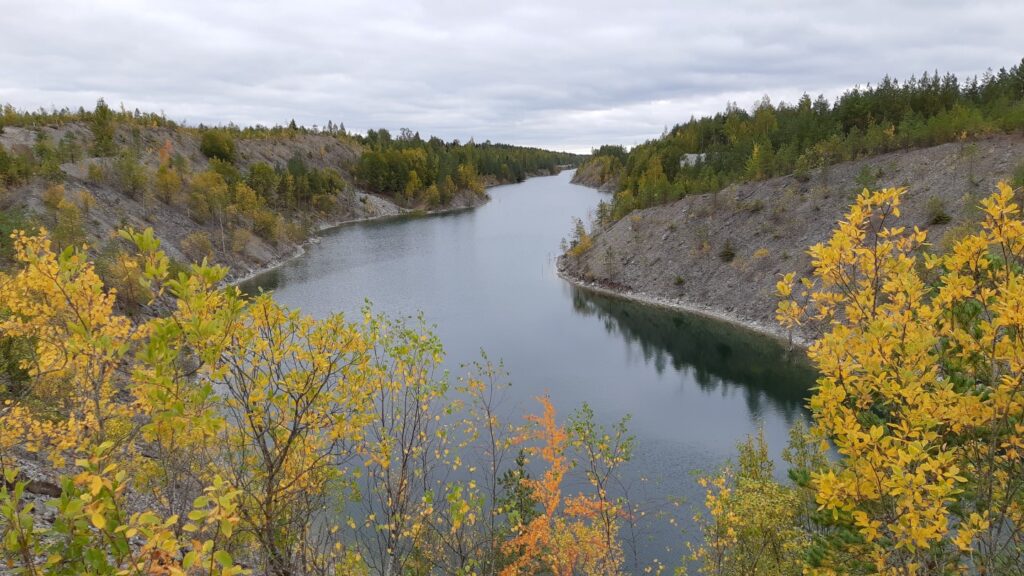
Aidu matkarada kulgeb mööda suletud karjääri kaeveala, tõustes kohati kõrgetele tranšeede nõlvadele ja siis laskudes taas orgu, kus saab ülevaate karjäärialade metsastamisest. Teele jääb ka veega täitunud kaevealasid millest ühte tuleb ületada parvega.
The pit stopped work in 2012 when the deposit ran out, and its roads and trenches then filled with water. The result is one of Estonia's strangest man-made landscapes: turquoise lagoons in a stony desert, their colour caused by light reflecting off gypsum crystals forming as limestone dissolves. The path climbs steep spoil ridges, descends into valleys being reforested, and crosses one flooded trench on a hand-pulled raft for up to four people. Take care on slopes in rain or snow.
Open it on the map Weather, fire danger, night sky and the way there
Download the trail (GPX)For Komoot, Wikiloc, Garmin, OsmAnd and other hiking apps
Place and description: RMK · rmk.ee ↗